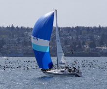
While this blog is based in Burnaby, British Columbia, Brad is currently still back east at sea on the Grand Banks, his ship coming from Yarmouth, Nova Scotia. As a mariner, I am certain that he has seen all sorts of weather conditions on the high seas. The weather forecast from Environment Canada for the Southeastern Grand Banks below will give you an idea of what this weekend is going to be like. He is to be joining me here on the west coast soon but until he does this will give you an idea of the conditions at sea. I hope to have some first-hand accounts from Brad on his experiences at sea soon as only he can tell it best. - Volker
Environment Canada Weather Forecast
Marine Forecast issued for Southeastern Grand Banks. Issued: 8.00 PM NST on Friday 07 March 2008.
Synopsis: An area of high pressure over eastern Newfoundland will move east of the district overnight. Light to moderate winds near the high will shift to moderate to strong southerly over most waters in its wake. On Saturday a low pressure system will approach from the southwest and cross Newfoundland late in the day. Strong southwesterly winds are forecast south of the low's track while strong to gale force northerlies can be expected to it's north.Marine interests are advised that gale warnings are continued for Belle Isle.. Northeast coast and Belle Isle Bank. Freezing spray Warnings are in effect for Belle Isle.. Northeast gulf.. Gulf-port au Port.. Northeast coast.. Belle Isle Bank and the Funk Island Bank northern half.
Forecast: Winds northeast 15 knots veering to southeast 15 overnight then increasing to southerly 25 Saturday afternoon. Winds veering to southwest 30 Saturday evening. Occasional rain beginning Saturday afternoon. Fog patches forming Saturday morning. Visibility fair In rain and poor in fog. Turning milder on Saturday. Outlook for Sunday...Strong to gale force southwesterlies.
Copyright © 2008 Environment Canada All Rights Reserved


m.jpeg)


-3.jpg)


No comments:
Post a Comment