
This past Saturday I spent a few hours having a look at the autumn colouur on
Burnaby Mountain, especially the western end of the mountain. These are just a small sample of photos I took that afternoon. If you go to my sister blog,
Haliaeetus, you will be able to see a lot more of them and other photos as well. To start off with the sun shining through the trees along
University Drive near the
Simon Fraser University (SFU) campus caught my eye. I did check it out from the other side but that proved not to be anything special.

Bikes are common around here and so is the grade in the road. It can get a lot steeper than the sign above may indicate. After all the rain we had recently, I there were lots of mushrooms growing about if you looked carefully, such as this clump of
fungi growing in a crack in a sawed off portion of a tree. Then the photo below that shows a peak of
Burrard Inlet looking through the trees along the path to the cherry grove, rose garden and restaurant.


Each year the colour of the leaves is a bit different on these cherry trees. One year they were more coppery in colour. I guess it has a lot to do with the temperature differences between day and night. Back east where I lived most of my life, autumns can be warm during the day and then frosty at night bringing out some very spectacular colour in the maples, like bright yellows, oranges and brilliant reds. Here though, I've found colours to be a lot more subtle with the odd punch here and there.

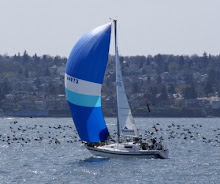
The image above looks north into
Indian Arm at
Burrard Inlet north of the
Burnaby Mountain. The upper reaches of this waterway disappear in the cloud and mist that is common this time of year. The photo below shows a close-up of the oil tanker in the above image. Yes, there is a refinery on the shores of
Burrard Inlet. The storage tanks for the oil are on the south side of the mountain. More on all that later.


The autumn colour was evident on the western end of
Burnaby Mountain from where the restaurant is located on south. The large shrub in the photo above is located to the north-northwest of the
Horizon Restaurant and below a very large beech tree. Below is a close-up shot of its reddish-coloured leaves. There are more trees and shrubs further south with yellows or muted reds from cherry trees to maples, and since the mountain is a remnant from the period where an ice sheet once covered
North America, there are rocks and boulders strewn along here and there. You can see them in various photos. There is even a circle of rocks with what looks like remains from a fire, likely a celebration of the
autumn equinox! What do you think?


The view of a walkway through part of the cherry grove and leading south away from the
restaurant. Below is another cherry tree in colour along the way back to the
Tran-Canada Trail.


A circle of rocks with the remains of a recent fire and we weren't invited to the celebration of the
autumn equinox? Well, perhaps this will happen next year.


The rocks and boulders remain from the ice age and add a nice touch to the landscape, don't you think? They certainly are a lovely added feature to these photos!


And finally, the view above looks west-northwest from the western end of the mountain. In the foreground is nearby
Capitol Hill with
Stanley Park in the middle background and the
North Shore further back. You can see a bit of the
Lions Gate Bridge on the right. The landscape in the distance disappears in mist. This area is part of a temperate rainforest. Below is a close-up shot of some maple leaves in various shades and colours. I hope you've enjoyed the journey and the photos! - V.
 This past Saturday I spent a few hours having a look at the autumn colouur on Burnaby Mountain, especially the western end of the mountain. These are just a small sample of photos I took that afternoon. If you go to my sister blog, Haliaeetus, you will be able to see a lot more of them and other photos as well. To start off with the sun shining through the trees along University Drive near the Simon Fraser University (SFU) campus caught my eye. I did check it out from the other side but that proved not to be anything special.
 Bikes are common around here and so is the grade in the road. It can get a lot steeper than the sign above may indicate. After all the rain we had recently, I there were lots of mushrooms growing about if you looked carefully, such as this clump of fungi growing in a crack in a sawed off portion of a tree. Then the photo below that shows a peak of Burrard Inlet looking through the trees along the path to the cherry grove, rose garden and restaurant.

 Each year the colour of the leaves is a bit different on these cherry trees. One year they were more coppery in colour. I guess it has a lot to do with the temperature differences between day and night. Back east where I lived most of my life, autumns can be warm during the day and then frosty at night bringing out some very spectacular colour in the maples, like bright yellows, oranges and brilliant reds. Here though, I've found colours to be a lot more subtle with the odd punch here and there.
 The image above looks north into Indian Arm at Burrard Inlet north of the Burnaby Mountain. The upper reaches of this waterway disappear in the cloud and mist that is common this time of year. The photo below shows a close-up of the oil tanker in the above image. Yes, there is a refinery on the shores of Burrard Inlet. The storage tanks for the oil are on the south side of the mountain. More on all that later.
 The autumn colour was evident on the western end of Burnaby Mountain from where the restaurant is located on south. The large shrub in the photo above is located to the north-northwest of the Horizon Restaurant and below a very large beech tree. Below is a close-up shot of its reddish-coloured leaves. There are more trees and shrubs further south with yellows or muted reds from cherry trees to maples, and since the mountain is a remnant from the period where an ice sheet once covered North America, there are rocks and boulders strewn along here and there. You can see them in various photos. There is even a circle of rocks with what looks like remains from a fire, likely a celebration of the autumn equinox! What do you think?
 The view of a walkway through part of the cherry grove and leading south away from the restaurant. Below is another cherry tree in colour along the way back to the Tran-Canada Trail.

 A circle of rocks with the remains of a recent fire and we weren't invited to the celebration of the autumn equinox? Well, perhaps this will happen next year.
 The rocks and boulders remain from the ice age and add a nice touch to the landscape, don't you think? They certainly are a lovely added feature to these photos!

 And finally, the view above looks west-northwest from the western end of the mountain. In the foreground is nearby Capitol Hill with Stanley Park in the middle background and the North Shore further back. You can see a bit of the Lions Gate Bridge on the right. The landscape in the distance disappears in mist. This area is part of a temperate rainforest. Below is a close-up shot of some maple leaves in various shades and colours. I hope you've enjoyed the journey and the photos! - V.


m.jpeg)


-3.jpg)


